Map & Orientation
Here you can find the 2026 camping map and the interactive map on BayernAtlas.
Interactive map
You can find further details and locations on the interactive map.
Open the interactive BayernAtlas map
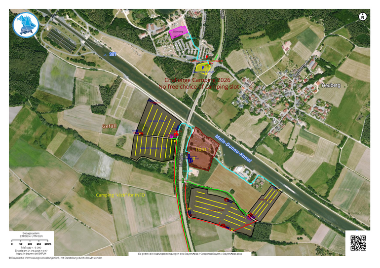
2026 Camping Map
2026 Camping Map. Click on the map to enlarge.
The terms of use for BayernAtlas / Geoportal Bayern / BayernAtlas-plus apply. Scale 1:5,000. Created on 21 June 2026. © Bavarian Surveying Authority 2026, displayed by the user.